Climbing steeply out of Beer this route takes you on a journey north inland to join the East Devon Way just west of the historic market town of Colyton. Passing through fields and woodlands and Holyford Woods Local Nature Reserve there are chances to spot a wide range of wildlife including wildflowers, deer, woodland birds and seabirds.
The area is also rich in history spanning millions of years from the geological history of the Jurassic Coastline to the more recent rebellions in the 17th century and smuggling in the 18th century.
Additional Information
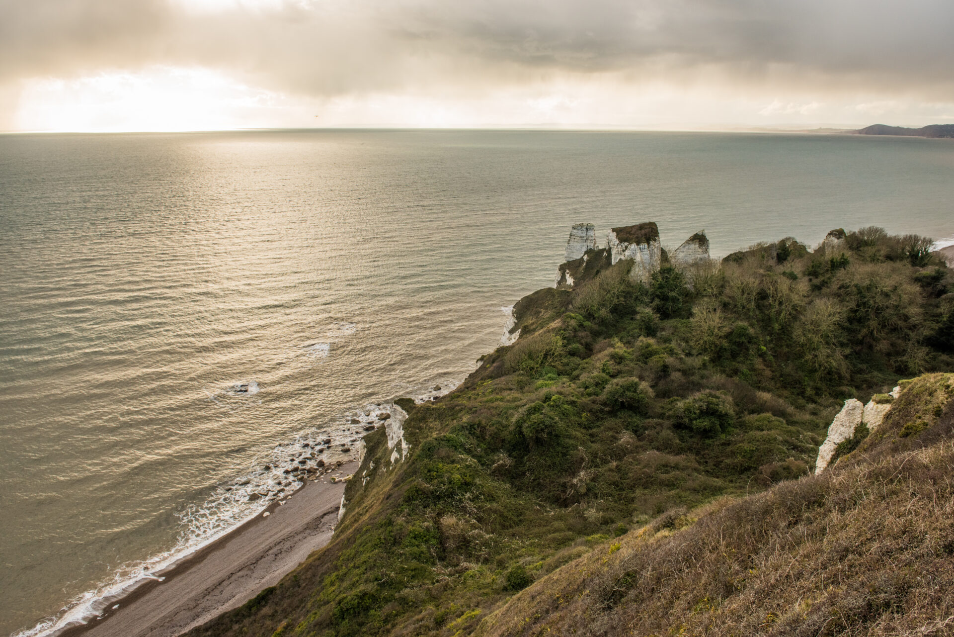
Nestled in a deep valley just west along the coast from Seaton, Beer was mentioned in the Domesday Book and has a long history as a fishing village. You can still see fishing boats on the beach today. Due to its hidden bay and nearby caves, Beer was also a notorious smuggling area in the 18th century.
Beer is also famous for its Chalk Limestone which has been used in many well-known buildings including Exeter, Winchester, St.Paul’s and Norwich, Cathedrals, Westminster Abbey and the Tower of London
Colyton was reputedly one of the first Saxon settlements established in Devon. It is known as ‘the most rebellious town in Devon’ due to the 105 local men and boys who supported the Duke of Monmouth in the Monmouth Rebellion, a plan to overthrow the King James II in 1685.
The main building of the church of St Andrew’s, in the centre of Colyton, dates back to the 15th and early 16th centuries, while the tower is 12th century with an unusual octagonal lantern top stage sitting on top. During renovation after a fire in 1933, a late 10th century cross was found, which now stands beside the font.
Directions
1 - 5 Continue to follow the narrow coast path...
…towards Seaton. Walking down past a field you will eventually come to T-junction.
2. Turn right at the junction with Old Beer Hill and walk down to a triangle roundabout.
3.Turn left inland along the road and after 219 yards/ 200 metres.
4. Turn right up the Permissive Footpath signed Coast Path (Seaton). Follow the path uphill and around to the right through woodland to the B3172.
5. TAKE CARE crossing the road and turn left along the pavement on the other side. Follow the road down and around a bend and take the first right along Bunts Lane.
6 - 10. After approximately 77 yards/70 metres...
…turn left along a minor road and then immediately right through a kissing gate to follow the footpath uphill into woodland.
7. At the cross tracks go straight across and continue to follow the footpath up through the woods. Bear right at the next junction.
8. At the junction of paths at the top of the hill, bear left and, ignoring footpath on your right, continue to a kissing gate leading into a fenced path alongside a field.
9. Go through the kissing gate and follow the fenced path along the edge of the field to another gate.
10. Go through the gate and head diagonally right through a metal kissing gate into a field. Follow the hedge on your right for a short distance before leaving the field through a 2 in 1 gate on your right. Turn left down the lane for a short distance.
11 - 15. Half way to the road turn left up some steps through the trees...
…into a grassy picnic area with amazing views of the Axe Valley. Head straight on through the picnic area staying parallel with the road on your right.
12. Continue alongside the road to the T-junction with the A3052. You will pass a petrol station and catch a glimpse of the Old Water Tower opposite.
13. TAKE CARE crossing the A3052 and go through a kissing gate onto a footpath through the field opposite. Follow the hedge on your right down to Holyford Woods Local Nature Reserve.
14. Go through a kissing gate into the woods and follow the footpath, keeping right at the first junction of paths and left at the next junction.
15. Follow the path around the edge of the old reservoir with the water on your right. Go over a footbridge and continue through the woods until you come to a kissing gate out into fields.
16 - 20 Go through the kissing gate and head straight on down...
…across the middle of the field.
17. Just before you get to the next farm gate double back, turning sharp left and following the bridleway up the slope to another field gate.
18. Go through the gate into the next field and turn right to walk parallel with the hedge on your right.
19. Go through a gate and turn left to follow the hedge on your left through two fields to a minor road.
20. Go through the gate and turn right along the road. Follow it to the next junction.
21 - 25 TAKE CARE and go straight across into Jobble's Lane...
…and follow it to the end ignoring the first footpath on your right.
22. Where the track divides turn right between the posts and along the footpath parallel with the boundary on your right. Follow the footpath to the end of the woods.
23. Turn right through a metal pedestrian gate and then immediately left through another metal pedestrian gate. Head downhill alongside the hedge on your right.
24. Go over a stile into the woods. Follow the footpath around to the right and then left as it winds down through the woods to eventually come out at a junction of two minor road (Heathayne Cross).
25. Cross both roads and take the track down to Heathayne Farm.
26-28 Go past the farmhouse on your left...
…and turn right through a gate to follow a track down towards the river.
27. At the path junction just before the ford bear left along the footpath beside the river to a footbridge. Cross the bridge to join the East Devon Way.
28. From here you can:
Turn left to follow the East Devon Way west towards Sidbury.
Turn right to follow the East Devon Way to Colyton and onwards towards Lyme Regis.
This route was originally developed by James Baldwin and checked by Ted Swan. It was reviewed and updated in 2026.