

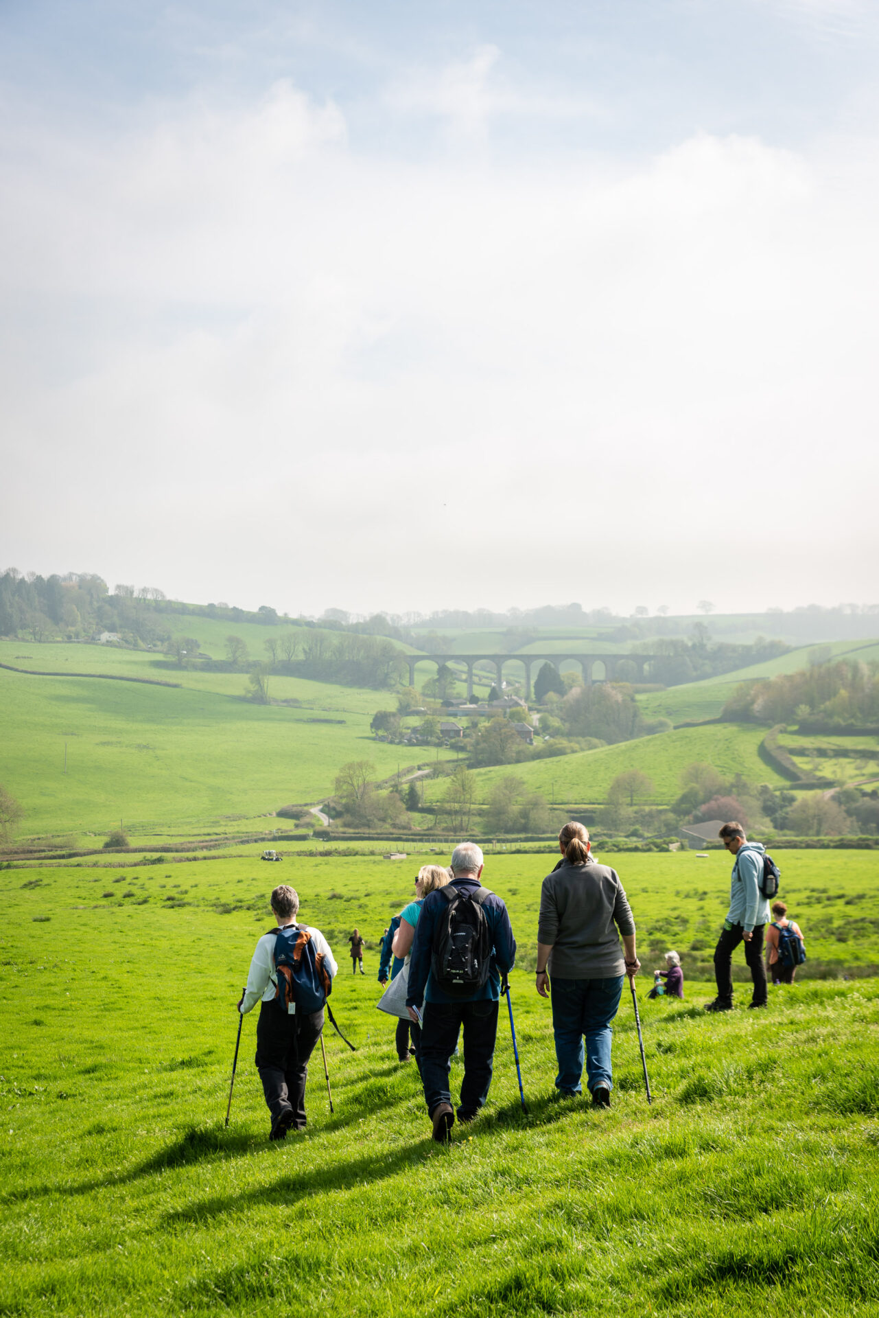
Starting in the market town of Colyton, this section of the route follows footpaths and quiet country lanes through the flood plain of the River Axe, with its wealth of wildlife, before climbing to the highest point at Musbury Castle, an Iron Age hillfort to the south east of the village of Musbury.
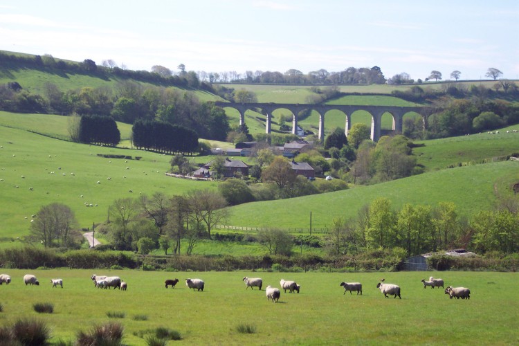
On a clear day you will have stunning views. Look back as you leave the hillfort to see the coast at Seaton, then look out to your right as you descend towards Uplyme for the Cannington Viaduct.
From Uplyme the route follows the River Lim path to the bustling seafront of the popular seaside resort of Lyme Regis.
Additional Information

The whole of the East Devon Way has been waymarked with these waymarkers to help you find your way.
Gallery
Quick view route description:
1 - 5. Turn right along River Mews...
1. Turn right along River Mews and follow concrete drive around between buildings and through a wooden kissing gate into a field.
2. Follow footpath parallel with the river on your left to a footbridge.
3. Cross the footbridge, turn right and follow the riverside path to a kissing gate. Turn left before it and follow the fence on your right away from the river until you come to a gate on your right.
4. Go through the gate and follow the fence on your left for a short distance to a footbridge on your left. Go across the bridge and through a gate and head diagonally right across the next field towards the tramway embankment.
5. Turn right alongside the embankment to the end of the field where you will find steps and a bridge over a pipeline onto the embankment. Cross the bridge and TAKE CARE following the signs across the tramway and alongside it to another set of steps down into a field on the other side.
6-10. Head diagonally right across the field...
6. Head diagonally right across the field to a stile, then stay parallel with the hedge on your right following the footpath to a minor road.
7. Cross the stile and turn left along the road. Follow it to the entrance to Lower Cownhayne and turn right along the footpath following the track beside the farmyard.
8. At the end of the track go through the kissing gate into a field and follow the hedge on your left. Just before the wire fence turn left through a metal pedestrian gate.
9. Go through the gate and turn right following the hedge on the right through a gap into a second field and on to a stile on the right.
10. Climb the stile and head diagonally left across the field to a gateway.
11 - 15. Go through the gate and head diagonally left...
11. Go through the gate and head diagonally left, staying alongside the river for a short distance before continuing diagonally left to the far left corner of the field.
12. Go through a 2 in 1 gate and stay parallel with the hedge on your right to the next 2 in 1 gate.
13. Go through the gate and head straight on through the next 2 in 1 gate before bearing slightly left across the next field.
14. Go through a metal pedestrian gate and turn right. Follow the footpath ignoring the first footpath on your left (Whitford Link) and continuing to a footbridge and metal pedestrian gate into another field.
15. Go through the gate and follow the footpath straight on with the river on the left. Head for the footbridge.
16 - 20. Cross the footbridge and follow the footpath...
16. Cross the footbridge and follow the footpath straight on and around to the right to the end of a road. Go through a 2 in 1 gate and follow the concrete road past Waterford Farm.
17. Where the road swings sharp left, turn right onto a footpath along a track. Follow the track for a short distance and turn left onto a footpath through fields.
18. Follow the hedge on the right across the first field to a narrow footbridge. Cross, go through a metal pedestrian gate and turn left.
19. Follow the fence on the left through double metal pedestrian gates. Turn right across the next field heading to the far right corner.
20. Go through a wooden field gate into a garden area. Follow the footpath heading diagonally left and then right over a footbridge, then straight on to a wooden pedestrian gate out onto the Seaton Road.
21 - 25. Go through the gate...
21. Go through the gate and TAKE CARE crossing diagonally left into The Street. Follow it into Musbury.
22. Follow The Street and when it swings left turn right up Church Hill.
23. Keep right (straight on) at the next junction and continue past the primary school and church on your left. Where the road divides bear around to the left up the drive to Musbury Farm.
24. Follow the drive uphill to the farmyard and follow the footpath around to the right over a cattle grid and up a fenced track.
25. After a left bend cross a stile on the right and head diagonally uphill through the field between the telegraph pole and enclosure to a 2 in 1 gate.
26 - 30 Go through the gate and straight on uphill...
26. Go through the gate and straight on uphill through an open grassy area. At the path junction continue straight on alongside the hedge on the right.
27. At the next path junction by the corner of the wood, turn left and follow a grassy track uphill.
28. At the path junction bear right and follow the path around the edge of the hillfort.
29. Continue to follow the path parallel with the trees on your right to a 2 in 1 gate. Go through and follow the path to the next 2 in 1 gate.
30. Go through the gate and follow the hedge on the left to a stile. Climb the stile, turn right and follow the fence on the right to a metal pedestrian gate. Look back to your left for a stunning view out to the coast at Seaton.
31 - 35 Go through the gate and follow the fence...
31. Go through the gate and follow the fence on the right to the end of the field. Turn right through a 2 in 1 gate and follow the hedge on the left to a stile out onto a minor road.
32. Turn right along the road and follow it for approx 1.1 miles/1.72km ignoring all side turns until you come to a road bridge. There are beautiful views out to your right along this section.
33. Go over the bridge and turn immediately right and then take the footpath on the left. Climb the stile and follow the hedge on the left.
34. Go through a gate into the second field and continue to follow the hedge on your left to climb a stile out onto a road.
35. TAKE CARE as you go straight across the across the road and through a metal field gate onto a grassy track.
36 - 40 Go to the top of the track...
36. Go to the top of the track and continue straight through the field alongside the hedge on the left.
37. Go through a metal field gate and follow a track straight on to a minor road.
38. At the road turn right and follow it downhill for approx 0.8 miles/1.2km ignoring all side turns.
39. At cross turn left up a tarmac lane. Just before cattle grid turn right along a footpath, going through a gate into a field.
40. Follow the hedge on the left, then as it swings left bear diagonally downhill towards a gate into the playing fields.
41 - 45 Go through the gate, over a footbridge...
41. Go through the gate, over a footbridge and walk along the left edge of the playing field until you reach a gate into Uplyme Village Hall car park.
42. Cross the car park in front of the village hall to the car park entrance and turn right along the pavement to a crossing. Cross the road and turn right along the pavement. At the end of the pavement go diagonally left across a house entrance and follow the tarmac path right in front of Dashwood.
43. Turn left along the footpath to Lyme Regis and follow it to the next road.
44. Go diagonally left across the road onto the footpath to Lyme Regis (River Lim Path) and follow it to the next road.
45. Go straight across the road and follow the River Lim Path along Mill Lane. Where the lane divides keep right and continue straight on when it turns into an unsurfaced track.
46 -50 At the end of the track turn downhill...
46. At the end of the track turn right downhill. Follow the bridleway around, above and parallel with the river, eventually dropping down to the right and around to a junction of paths.
47. Turn right over the footbridge and then left to follow the footpath to Lyme Regis staying parallel with the river on the left.
48. Go through a gate and follow the footpath over two footbridges and around to the right to follow the river. When the path joins a surfaced road turn right to follow the footpath to Lyme Regis.
49. Ignore the footpath on the right (Haye Lane) and continue straight on along the tarmac road to a crossroads by a bridge.
50. Go straight across into Windsor Terrace and continue past Higher Mill Flats to another cross roads.
51 - 54 Go straight across into Jericho...
51. Go straight across into Jericho and follow the tarmac road to the end. Turn right over the footbridge and then left along the River Lim Path.
52. At the end of the path turn left along the road and follow it to the next junction.
53. Turn left and then on the bridge turn right along a tarmac path between two water courses. Follow it around to Town Mill.
54. At the end of the path turn right between the Micro Brewery and the Mill and walk straight on over a footbridge and up some steps to a car park. From here you can either bear left down through the car park to the road and the seafront or bear right and then left along the path to the shops via Drakes Way.
This route was reviewed and updated in 2026.